
In this article (3)
The Territorial Development Scheme (Schéma de développement du territoire, SDT), in force since 1 August 2024, distinguishes centralities from the rest of the territory. The centrality type serves as a reference, particularly for the unsealed ground (pleine terre) ratio, but it does not on its own determine what you can build:
- the SDT’s regional measures on unsealed ground apply to sites larger than 0.5 ha;
- the SDT’s spatial optimisation guidelines only apply to permits from 1 August 2030 (except for certain commercial permits);
- until then, a municipal development scheme may already set its own measures.
The unsealed ground data requested in Annex 4 are collected for statistical monitoring purposes (SPW FAQ, question 1). So check the provisions applicable in your municipality before drawing conclusions about a buildable area.
Airplan detects this data automatically: no need to look it up on WalOnMap. You will find it in three places: the “Contexte” (context) column, the feasibility study and the map set.
In the Contexte column
You will find it in the “Contexte” (context) column, which appears when you edit the content of an annex. This column lists the planning data that apply to the project, so you can keep an eye on them while you complete the application, for example when filling in the unsealed ground box in Annex 4.
- Open an annex for editing: the Contexte column appears at the side.
- In the Urbanisme et planification (planning and zoning) theme, find the “Type de centralité” (centrality type) box: the detected data are shown there, for example Centralité urbaine de pôle (urban hub centrality).
- Click the box to display the map.
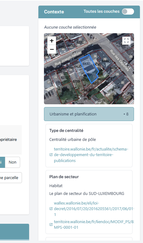
💡 This works for any other planning data: click the box for the theme you are interested in and the map appears.
In the feasibility study
If the project is located in a centrality, it is the first piece of information shown in the feasibility study.
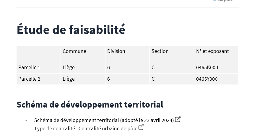
As a reminder, studies only list the data for which information has been detected. If the project is not in any of the centrality types, there will be no mention of it.
In the map set
The generated map set works in the same way. If you keep the default settings, only the maps for which data have been detected are shown: if the project is in a centrality, a map will therefore be generated.
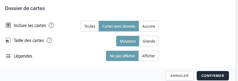
💡 If you want a map even when there are no data, select the “Toutes les cartes” (all maps) setting. A centrality map will be generated and you will see that the project is not in a centrality. It does, however, let you see the nearest centralities.