
In this article (5)
On many plots, the map of vicinal roads and paths shows nothing in particular, which is good news. But when a route does appear, it deserves your full attention, even if nothing can be seen on the ground.
A public road, even when it cannot be seen on the ground
Vicinal roads and paths are listed in the Atlas des chemins vicinaux (Atlas of Vicinal Roads), drawn up from 1841 onwards. A road recorded in the Atlas keeps its public status even if it cannot be seen on the ground or is missing from the land registry: ploughed over, fenced off or overgrown for decades, it legally remains a public right of way until it has been officially closed.
Walloon regulations point in one direction only: preserving public roads. Since the Decree of 6 February 2014 on municipal roads, creating, modifying or closing a municipal road, vicinal roads included, requires a municipal procedure with the prior approval of the municipal council, subject to the conditions set out in the decree.
Since 1 September 2012, a public road can no longer disappear simply through prolonged non-use. A 30-year prescription for public non-use already acquired before that date can still be invoked before the courts (Court of Cassation, 27 May 2021, C.20.0019.F). It must, however, be proven in each case: the fact that the road is no longer visible is not enough.
What this means for your permit application
- Building on the line of a vicinal road, or obstructing it, first requires a procedure to modify or close the road, before or alongside the permit application.
- An application that ignores a road recorded in the Atlas is exposed to an incompleteness notice. And a permit granted regardless can be challenged by a third party with standing to bring proceedings, through the available appeals.
- This map was added to the generated documents precisely because Airplan users had received incompleteness notices.
Where can I find the map in Airplan?
The “Atlas des voiries vicinales” (atlas of vicinal roads) map is generated in your project’s map set, alongside the other official maps. To add it to your application, see how to attach maps to your project.
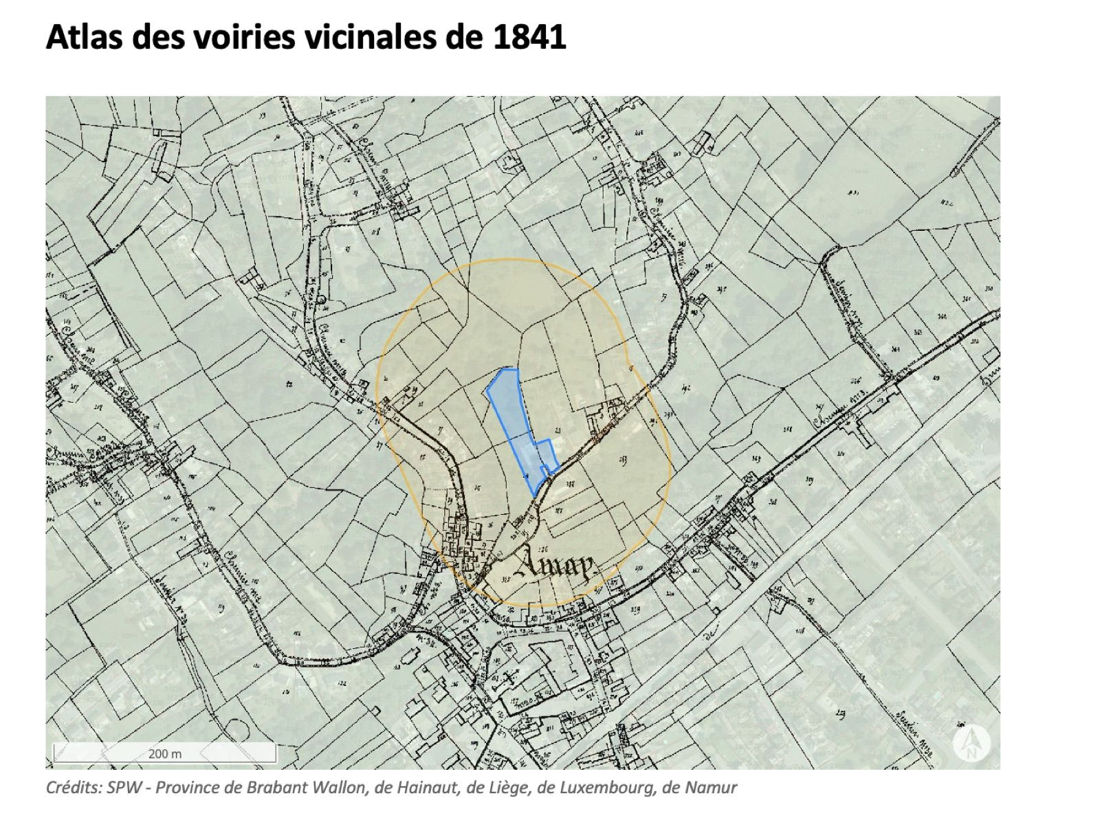
What should I do if a route appears on my plot?
- Check whether the route crosses the footprint of your project or only a corner of the plot.
- Ask the municipality’s planning department about the current status of the road: the municipality’s position is authoritative.
- If the project encroaches on the road, plan for the municipal road procedure before submission: your municipality will tell you how to proceed.
Further reading: the Decree of 6 February 2014 on municipal roads sets out the current procedure, and the Court of Cassation judgment of 27 May 2021 deals with prescriptions acquired before 2012.
The map’s limitations
This data has no legal value and is not exhaustive: only the municipality can confirm the status of a road. In addition, the municipalities of the East Cantons and the old town centres have no atlas of vicinal roads, so no plan or modification is available there. Some atlases have also never been found.
💡 A route on the map does not block your project: it simply means you need to check with the municipality before submission. Ten minutes of checking is better than an incompleteness notice or an appeal.