
In this article (3)
Airplan can automatically position your photos on the map if they contain GPS location data (EXIF). If they do not, you can position them manually in a few clicks.
🔍 1. Why is my photo not located automatically?
For Airplan to geolocate an image automatically, it must contain EXIF geolocation data. If it does not, this is usually due to one of these situations:
| Situation | Result | What to do |
|---|---|---|
| 📲 Photo taken with location turned off | ❌ No GPS coordinates | Turn on location on your phone |
| 💬 Sent via WhatsApp or Messenger | ❌ EXIF data removed | Send the photo by email or via Google Drive |
| 🖥️ Copied and pasted from a viewer | ❌ No EXIF data | Upload the original file directly |
| 🔄 Photo converted to JPEG before sending | ❌ EXIF often lost in the conversion | Send the original file: Airplan accepts HEIC as it is |
No more need to convert your iPhone photos
Airplan now accepts photos in HEIC format, the default iPhone format, in every file upload field, and the location is kept. So you no longer need to convert them to JPEG first: that conversion was often what caused the GPS data to be lost. Support depends on the browser: it works with Safari 17 or later on Mac. Other browsers (Chrome, Firefox, Edge) reject HEIC photos with the message “Les photos HEIC ne sont pas prises en charge par ce navigateur” (HEIC photos are not supported by this browser).
Checking whether your photo contains geolocation
On iPhone:
- Open the photo.
- Swipe it upwards.
- If the photo contains geolocation, a map appears showing where it was taken.
- If no map appears, the photo contains no location data.
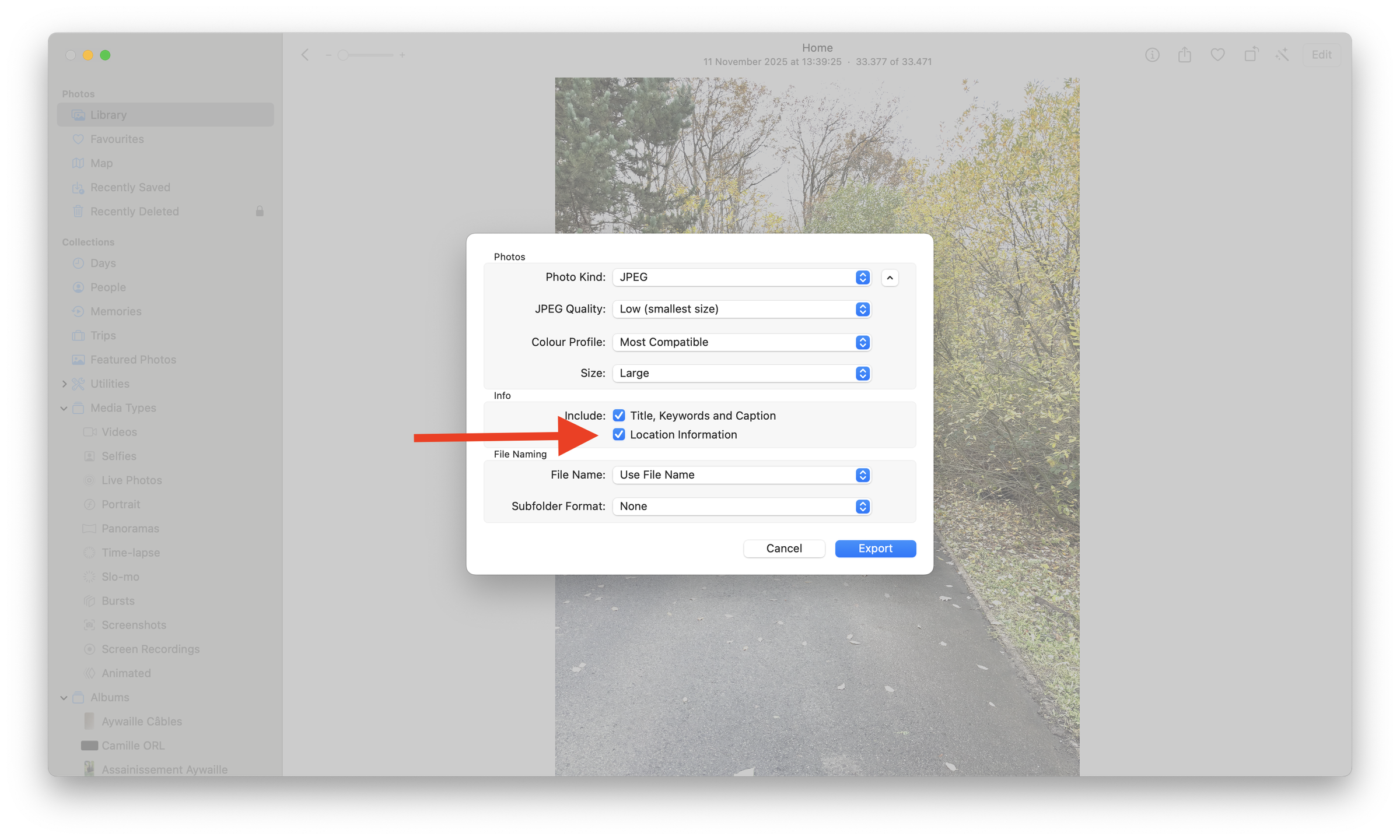
On Mac: when you export your photos from the Photos app, make sure the “Location Information” box is ticked.
📱 2. How do I turn on geolocation for future photos?
On iPhone
- Open Settings → Privacy & Security → Location Services → Camera.
- Choose “While Using the App” or “Always”.
On Android
- Open Settings → Location → App location permissions → Camera.
- Allow access to location.
🖱️ 3. How do I position a photo manually on the map?
If your photo contains no EXIF data, Airplan lets you locate it yourself:
- Click the unlocated image in the left-hand column: the message “Cliquez ici pour la positionner” (click here to position it) appears.
- Click the map where the photo was taken: an arrow appears.
- Adjust the position and orientation using the two handles.
The two handles:
 The triangle moves the photo on the map.
 The numbered bubble adjusts the orientation, in other words the angle from which the photo was taken 🔄
💡 Even without EXIF data, your photo report remains fully usable thanks to manual positioning.